Early Warning System for extreme weather conditions at Agious Deka

meteorology
05 Sep 2019
/ 10:01
CORFU. The Institute for Environmental Research and Sustainable Development has set up a 4th generation meteorological radar system at Agious Deka for four months.
The Institute for Environmental Research and Sustainable Development at the National Observatory of Athens in conjunction with Corfu Municipality and Corfu Civil Aviation Authority, as part of the cross-border project i-ALARMS (Interreg–IPACBCGreece - Albania), is developing an Early Warning System for extreme weather conditions (thunderstorms, fires) and their impact (flooding, landslides and extreme instances of coastal and Natura region erosion) to cover Corfu.

The basic component of this type of system is real time measurement with a modern meteorological radar in conjunction with satellite observations and meteorological stations on Earth that already exist or are to be developed. These measurements will be fed into short-term and long-term meteorological and hydrological models, thus significantly improving their reliability.
The forecasts will be available in real time to both public and private organisations that require the information, thus assuring the viability of the system to the general public. The forecasts can be used for management and utilisation of available water resources - reservoirs and basins as well as bodies of groundwater and managing the danger of flooding. Suitable decisions will be able to be made to deal with the consequences of natural disasters (drought, floods, heatwaves, freezing, areas cut off by snow, floods etc.).

The first, key stage of developing the system includes setting it up modern flexible (easily transportable) small, low-cost meteorological radars with a range of up to 120km on low-altitude peaks (500m).
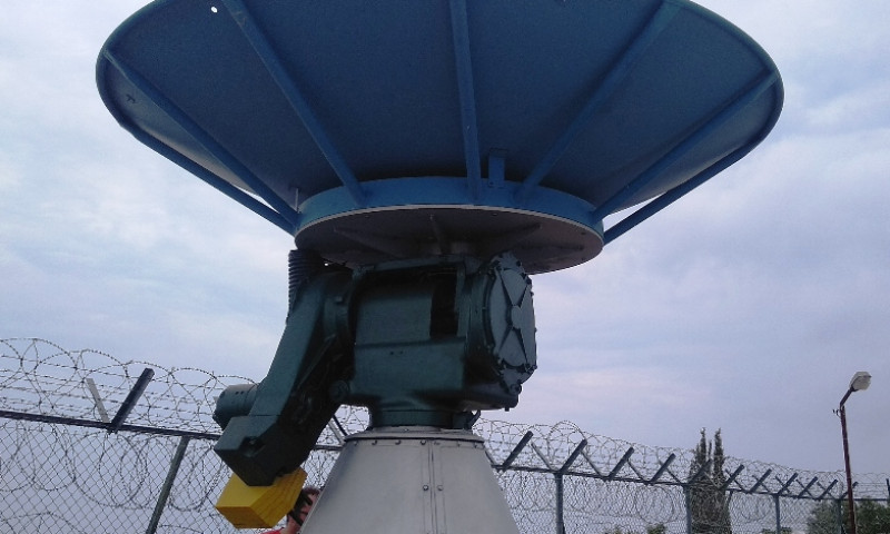
To this end and as part of the Institute for Environmental Research and Sustainable Development's cross-border project, a 4th generation meteorological radar was successfully set up on 1 September for four months. The XPOL radar has been set up at the same location in Agious Deka as the Civil Aviation Authority approach radar.


The basic component of this type of system is real time measurement with a modern meteorological radar in conjunction with satellite observations and meteorological stations on Earth that already exist or are to be developed. These measurements will be fed into short-term and long-term meteorological and hydrological models, thus significantly improving their reliability.
The forecasts will be available in real time to both public and private organisations that require the information, thus assuring the viability of the system to the general public. The forecasts can be used for management and utilisation of available water resources - reservoirs and basins as well as bodies of groundwater and managing the danger of flooding. Suitable decisions will be able to be made to deal with the consequences of natural disasters (drought, floods, heatwaves, freezing, areas cut off by snow, floods etc.).

The first, key stage of developing the system includes setting it up modern flexible (easily transportable) small, low-cost meteorological radars with a range of up to 120km on low-altitude peaks (500m).
To this end and as part of the Institute for Environmental Research and Sustainable Development's cross-border project, a 4th generation meteorological radar was successfully set up on 1 September for four months. The XPOL radar has been set up at the same location in Agious Deka as the Civil Aviation Authority approach radar.


